
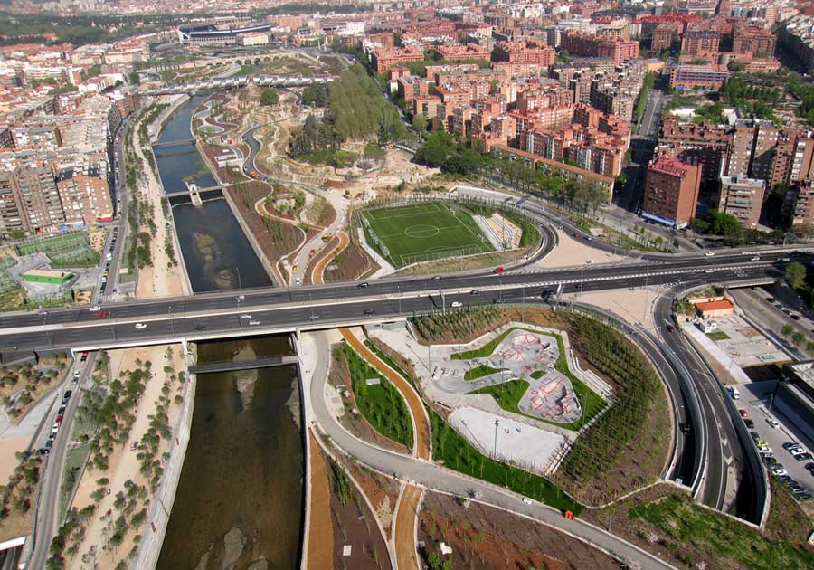

Oftentimes, massive transportation projects like bridges and highways can do more harm to a city than good. While they may bring efficiencies in the movement of people and resources, they can also end up marring a city permanently, dividing neighborhoods and bringing few quality of life improvements for residents. In contrast, some projects, like New York City’s Central Park or San Antonio’s River Walk, had such a breadth of vision and embedded social good that they permanently altered the shape and image of their cities for the better and have become an iconic emblem of their respective cities. Now Madrid, utilizing this rare vision and bold initiative is aiming to create its own masterpiece by reclaiming its own riverfront. The plan is grand in scale, breathtaking in its beauty, and far-sighted in its vision, putting the public’s interest at the forefront.
The Madrid Rio Plan was conceived when the city buried the M-30 ring road highway, which runs through the center of the city and parallel to River Manzanares, into a tunnel. After the highway was submerged, it freed up more than 1600 acres of land and more than six miles of waterfront access. In 2005, West 8, with several renowned architects from Madrid including MRIO Arquitectos, was awarded the contract to design the master plan for Madrid’s Rio. West 8 and MRIO’s proposal for the reclaimed land was the only design submitted to address the issues of newly opened up space in the middle of the city with landscape architecture. Their bold vision, adopted by the Mayor of the City Alberto Ruiz-Gallardon in 2006, changed the city center forever: it proposes to create a long stretch of parks along the river bank which aims to bring residents of the city to the waterfront for recreational and sporting activities.

The project removed the above-ground highway, seen as a barrier which separated many neighborhoods and communities, and ran through the city center. Both banks of the River Manzanares, and many side streets, were brought together by creating new bridges and public gathering places along the water’s edge. The reclamation of the land along the river bank not only altered the course of the river but improved the water quality. One of the most important aspects of the design was to create a dialogue about how water can be brought as a living force into the cultural and recreational facilities newly built along the river’s banks, which now include parks, beaches, rowing births, and different streams, each with their own character.
The most astonishing part of this grand enterprise of tunneling the M-30 highway and replacing it with public space, at the cost of six billion Euros (US$7.8 billion), was that it was accomplished in only one term of office by Mayor Alberto Ruiz-Gallardon. Madrid Rio would be considered one of those landscaped projects which will forever mark Madrid for good.
Leave a Reply