

Last century, architects and urban planners had to deal with the fact that vehicles were rapidly increasing their presence in cities. To solve the relationship between cars and pedestrians, some proposed to separate them.
A relevant example of these urban planners was Clarence Perry, who developed a concept in the early 1900’s called the “Neighborhood Unit” that proposed residential developments be built around basic services, like schools, and would be accessible on foot, so people wouldn’t need to use the car in their daily life. There are some built examples of this concept, one of the most relevant is Radburn, New Jersey. He also had a big influence in later projects like English New Towns.
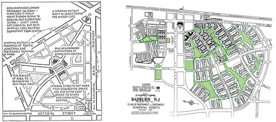
Fig 2: Radburn, New Jersey (fradkinmcalpin.com)
This approach, that works fine for a suburb, does not seem so easy to apply in a big city center, where the urban fabric is more complex and the car presence stronger. This was the challenge The Smithsons faced in the Berlin Hauptstadt contest in 1957. They resolved it with an utopical design that included an upper-level platform for pedestrian and a lower-level street network for vehicles that should provide equal freedom of movement and access to both of them (you can appreciate it in the sketch in fig. 3 and 6).
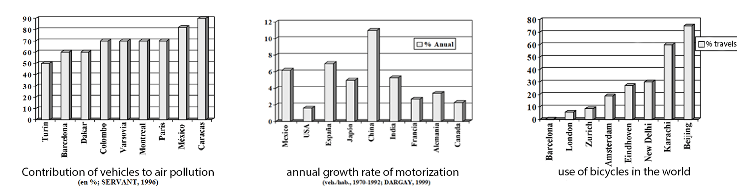
Smithsons’ designs didn’t become realized in our current cities, where cars are currently sharing the same urban space with bikes and pedestrians, who may feel vulnerable in this situation and be dissuaded to go on foot and become drivers, which has a direct influence in pollution levels. (see graphics)
Nowadays these interesting and utopical proposals are nearly forgotten, but New York and Madrid have recently built big upper-level pedestrian platforms like the High Line and Madrid Rio with a surprisingly similar design to the Smithsons’ (see images below).
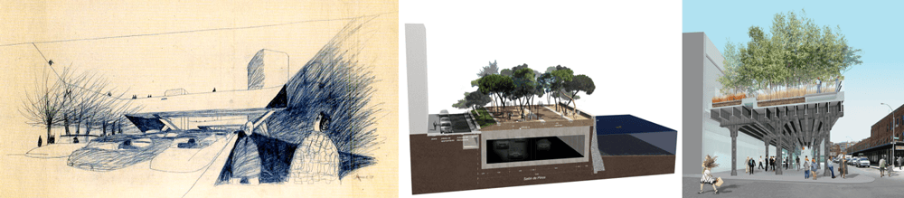
Fig 4: Madrid Rio (archdaily.net)
Fig 5: The High Line (thehighline.org)
Although both High Line and Madrid Río seem to have been conceived as promenades or green areas, I think it would be very easy to use them as pedestrian paths to reach city services such as schools, libraries or commercial centers. This could be encouraged by perhaps taking actions like redesigning intersections at some points, redistributing traffic around these axes or just suggesting to citizens through advertising campaigns, to walk through a nice, secure pedestrian path to get to their work, shops, etc.
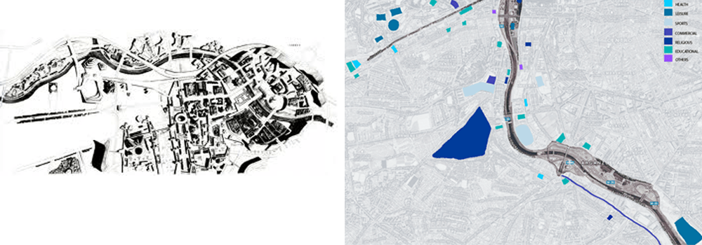
Fig 7: Services around Madrid Rio (made by the author)
.
Being more ambitious, if this idea of being near a pedestrian path becomes a profitable value for commercial centers, schools or whatever, projects like the High Line and Madrid Rio could become the seed of a pedestrian network connecting services in cities as the Smithsons once imagined. Especially since funds to improve cities (needed to make more upper-level platform for pedestrians) appear when someone is able to create the expectation that money would be made by those improvements.
Note: while I was writing this post, the New York Times published “High Line’s Best-Kept Secret: It’s a Fast Commute” which points out how many local residents use the High Line as a means to get to work. It’s nice to see how citizens use the city wisely. What would happen if this secret becomes a urban strategy?

Laura de la Plaza is an architect and urban planner, you can see more about her here.


Leave a Reply