
It’s winter again in Boston. Anyone who was there last year during February and March knows what that means. The ability to move about the city could come to a screeching halt in the blink of an eye.

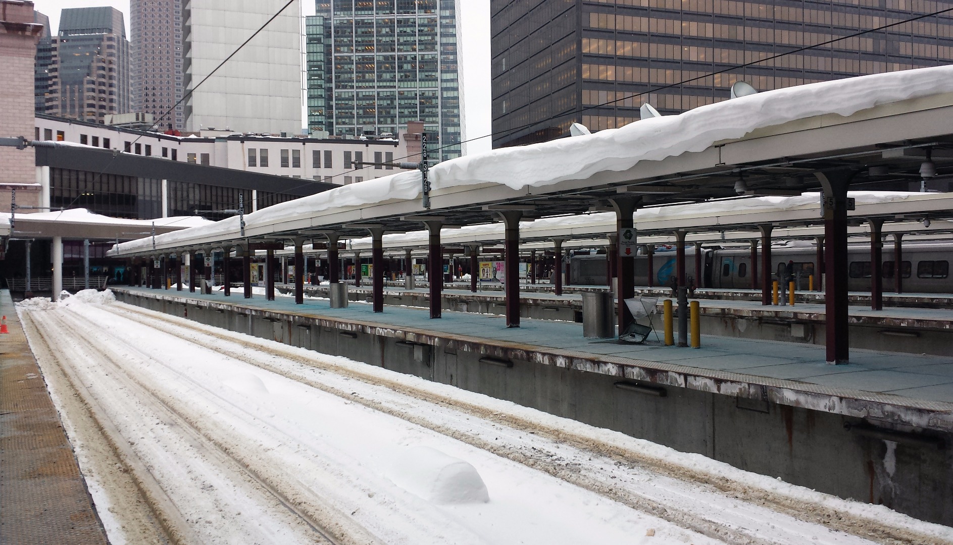
 Boston (Riel, 2015)
.
The Massachusetts Bay Transportation Authority (MBTA, or the “T”) completely shut down last winter after repeated large winter storms, stranding thousands of travelers and creating severely overcrowded trains and buses on services that were operational. The T relies every day on outdated, obsolete, overburdened, and overstressed equipment, some of which was built a full seventy years ago, shortly after the end of World War II. Before the storms that brought the T to a halt last winter, we knew that the MBTA had a maintenance backlog upwards of $5 billion. It is now estimated to be upwards of $7 billion. If nothing more, last winter proved that the continuing trend of kicking the can down the road on putting together a feasible plan to address the MBTA’s needs is materially harmful to the residents of eastern Massachusetts who currently rely on the T.
Yet despite this, demand for transit services in Boston has been growing. Since 2010, the number of unlinked trips on the MBTA has increased by 15%. In the same time period, the population of the Boston area grew just 6%. And Boston is hardly alone in seeing increasing demand for transit: all across the country, transit ridership is growing (except in D.C.). Transit agencies across the United States handled more than 10.5 billion unlinked trips in 2014, a 5% increase from 9.95 billion in 2010. The population of the United States grew just 3% in the same period.
While Boston’s elected officials wrangle over whether or not to fund the Green Line extension, new transit services in other parts of the country, such as the new Green Line light rail in Minneapolis and Saint Paul, Minnesota and the CTfastrak system in Hartford, Connecticut have been so successful that they are approaching their 2030 ridership goals nearly fifteen years ahead of schedule.
Clearly, there is a serious disconnect between Boston’s demand for transit and our leaders’ willingness to provide that transit. Right now, the state and city have just agreed to spend almost $150 million to encourage General Electric to move its 800-person corporate headquarters to Boston, while concurrently the T’s new Fiscal and Management Control Board is doing its utmost to kill the MBTA’s popular late night service and save a mere $14 million. Our leaders are willing to develop Boston as a hub of innovation, but not Boston as a hub for transportation.


.
Why are many cities across the country choosing to expand and improve the quality of their transit systems, while cities such as Boston are unable to come up with the political willpower to even maintain the systems they have? Are Boston’s transit woes just political, or is it the case that it is actually impossible for transit to be fiscally sustainable for cities and states? Is it possible for cities such as Boston to not invest in transit, given that urban areas are seeing population growth at a significantly greater rate than the rest of the country?
Yes, the T is underfunded, perhaps partly because of a persistent stigma against public transportation in America, and its connection with race, class, and suburbanization. And yes, the T operates America’s oldest public transportation network, and newer systems do not have as many maintenance issues. Plus, granted, it’s harder to be creative on Boston’s narrow streets, built before the age of the automobile. Newer cities have a lot more room for bike lanes, light rail, or bus lanes. Density is also still a dirty word in some circles. Understandably, density used to mean disease, and in fact, New York’s private companies were forced to build into the outer boroughs (which were, back then, still largely rural, having only recently been consolidated) in order to alleviate congestion in Manhattan. (They also were forced to maintain a low fare, even along these low-ridership segments, which contributed to their bankruptcy).
But surely the T could also manage its finances better. Unfortunately, for public authorities, there is a lack of a profit motive, and the T’s bureaucracy is not properly incentivized to perform more effectively and efficiently for the 21st century. Due to this, akin to other public authorities, they lack the expertise necessary to reform themselves. They lack a narrative. Can they even be trusted with more of the public’s money, when customers lose faith in arriving on-time, resorting to their vehicles and resulting in more clogged roads?
As a public authority, the T is risk-averse, and it has no will to innovate (especially in terms of transportation finance and real estate development), while it is hard for it to coordinate with private partners. The problems facing the T cannot be solved merely by providing more funds to the authority, or by raising fares.
While these measures will certainly help, larger structural problems must not be ignored. Radical change is necessary, but there is no will to do it, partly because most people do not understand the core problems facing the authority and partly because people don’t want to pay for improvements. In the City of Boston, only 33% commute with the T, so the majority don’t know how bad it can be during rush hour, or during blizzards.

.
Streamlining all transportation agencies (except for Massport) into a single MassDOT in 2009 was a significant step towards greater efficiency, but politics get in the way of most long-term planning. In the New York region, which has many more authorities, and three states to coordinate, more still arguably seems to get done while Boston and its increasing population is left to increasingly congested and delayed roads and rails. (Though, the T does have cell service and countdown clocks, while the 24/7 NYC subway continues to work on implementing these services in all 469 stations).


.
I know that it is a feat to move so much complex machinery every single day and that Boston’s existing infrastructure is crumbling, so it’s hard to focus on the future. But, if leaders don’t act, Boston will be left behind with its early 20th century technology and serious institutional disconnects. In fact, by 2020, without additional investment, the MBTA projects that its annual operating deficit will more than double, to $430 million.
Clearly, we need to find creative ways to finance the renewal, enhancement, and expansion of our infrastructure. Because in the end, in order to physically bridge the gap, we’ll first bridge it socially, economically, and politically, transporting it into the 21st century. Change is constant, but we must plan for it, so that Boston can continue to prosper into the 21st century and beyond. Building an underground North-South Rail Link, and building a Red-Blue Connector, for instance, in order to bridge the gap and fill the void.


.
To begin thinking about reform, it’s important to recognize that even though the T is a perpetually cash-strapped authority, they curiously lack the motive to innovate. Why, for instance, have they not built a taller facility for their one-story Red Line station entrances at Davis Square, when surrounding buildings are all at least a few stories tall?
Davis Square is the hustling central business district of the thriving City of Somerville, and the T could build additional stories atop their entrances in order to rent to a supermarket (Trader Joe’s), and build apartments and increase the supply of housing in the neighborhood. This would create jobs, provide a better transit experience, and improve the dynamism of Davis Square.


.
Moreover, if the Green Line Extension is built, the corridor between it and the Red Line at Davis Square would need to be improved. Perhaps for active transportation, connecting Trader Joe’s with my school’s fitness center near the Green Line. As seen in this zoning map for my active transportation course, in Medford, the corridor is surrounded by Tufts University (and privately-owned fields). But in Somerville, the corridor passes through residential neighborhoods, before entering Davis Square, which is the CBD of the City of Somerville. The area is quite dense and primarily composed of renters (renter occupied) rather than owners (owner occupied), especially along the corridor buffer.
Conveniently, as a state authority, the T does not even need to obey municipal land use or zoning regulations, and that renovated Davis Square station would have all the real estate revenue necessary for maintenance, just as the Green Line Extension would have ample funding if developers contributed to construction costs in exchange for building tall along the route and atop the future station structures. Indeed, this is how the proposed light rail in Brooklyn and Queens in New York City would primarily be funded, with ample new housing to be built in order to meet demand and alleviate (at least some) valid affordability and displacement concerns.


.
But unfortunately, the T does not have a developer mindset, and it is hard for it to coordinate with private partners. Plus, local residents would surely (and sadly) object to change and to increased density. Even though the city is growing and demand needs to be met in order to combat displacement, politicians tend to bow to the fears of current residents, without considering the voices of those that would like to move into the community.
And to be fair, even if the T maximized its limited assets for transit-owned development, it would still be quite marginal and it would still need plenty of additional funding from the Commonwealth. Many of the T’s real estate assets are in far-flung locations, where the costs associated with decking atop active operations would make joint development infeasible. Yet in Davis Square, there is arguably no valid excuse.
As a public authority, the T is risk-averse, and even though it does not legally need to follow municipal zoning regulations, it has no motive to innovate. Also, as aforementioned, the T is controlled by politicians that easily bow to Not In My Backyard (NIMBY) activists. These so-called progressives are strangely against progress.
Yes, increased density could mean increased congestion, which is a valid concern, though building atop a rapid transit hub would be the best place to alleviate vehicular congestion concerns. And the region is growing regardless of whether or not buildings become taller; in fact, if they don’t become taller, housing costs will continue to rise while poorer people continue to be displaced.

.
The Green Line Extension, which theoretically would reach my school, Tufts University, at the College Avenue and Boston Avenue intersection, may not be built. Unlike the Green Line elsewhere, this section would be built alongside the existing commuter rail tracks, separated from the roads, so it would be faster and more convenient. And my campus would have a new gateway — perhaps to be fondly known as College Square — with extended sidewalks and new facilities for learning and socializing. This area of campus is already growing, with 574 Boston Avenue and the soon-to-be completed SEC, as well as the new Central Energy Plant, and the renovated Memorial Steps.
In fact, Tufts rightly understood that space would be available atop the station entrance for development, so they proposed an Air Rights Building, and developed a public-private partnership (P3) in order to have a 99-year lease on air rights. Tufts will be paying for project redesign and construction changes for the station below (if the project moves forward), and paying for ongoing maintenance and station security. This practice is known as value capture, and in particular, joint development, and it is a form of transportation finance.
The school may even be building a pedestrian bridge to the Air Rights Building from the Academic Quad, bypassing College Square below, in order to increase pedestrian capacity throughout campus and above the dangerous intersection, currently with narrow sidewalks and a lack of public space. In fact, Tufts already has many skyways at its Boston campus, where it continues to expand towards the skies, and manage ground-floor retail. (But do these skyways detract from street dynamism? Probably.)


.
While the T may be risk-averse, especially concerning real estate development, Tufts clearly does not appear to share these traits. In fact, Tufts even tried to build directly atop South Station’s train platforms between the terminal and the bus station, creating the Tufts University Development Corporation (TUDC) in the 1980s in order to secure permits and air rights and build a skyscraper originally designed with a height of 759 feet. Of course, former University President Jean Mayer, arguably Tufts’ greatest visionary, was the man behind this proposal, envisioning the creation of a skyscraper dedicated to medical research decked atop the station.

.
Due to a lack of real estate expertise of this scale and complexity, the university brought on Hines Interests LP, a development firm, in the 1990s. Since then, money and politics have gotten in the way, as well as additional complexities related to decking and ventilating atop New England’s busiest (diesel) rail terminal. Thus, the South Station Tower remains on hold, with potential plans for a hotel, condominiums, and office space. Moreover, due partly to vibrations from the trains below, it is unlikely that Tufts will have a place in the skyscraper. However, Tufts would nevertheless be the visionary behind improving South Station, providing real estate revenue to MassDOT, and improving the Northeast Corridor experience.
According to Tufts University Professor Gittleman, President Mayer had a vision of pharmaceutical companies coming into Boston and attaching themselves to the Tufts medical school, with Tufts building facilities atop rail and road transportation assets, from South Station to the Boston Turnpike. While this impressive, LEED pre-certified building is on hold, President Mayer succeeded in getting the university itself ‘on track’, with a sizable endowment and the creation of the Human Nutrition Research Center on Aging, the nutrition school, and the veterinary school.
Clearly, President Mayer understood the importance of interdisciplinary connections — indeed, of bridging the gap socially, economically, politically, and physically — and taking risks. In fact, his vision increased undergraduate enrollment so much that while new dorms were being built, the university needed to shuttle students to a hotel in Harvard Square. And no, unfortunately, they did not just give them free T passes.
Unlike most Northeast and Midwest cities, Boston continues to compete with the Sun Belt’s relatively cheaper cities, which began to boom during the rise of the interstate highway era and the advent of air conditioning. It attracts the best and brightest, keeping it competitive, and it is strong and resilient because it is constantly changing. New students come every year to its anchor institutions, fueling Boston’s innovation economy. But it needs some constructive criticism. And, it also needs some construction.


.
All of this economic activity does have its consequences. Boston is becoming even more expensive. According to Rachel Slade for Boston Magazine, the cost of living in Boston is 39.7 percent above the U.S. average, while median household income remains on par with the rest of the country. Thus, in order to pay for housing, more than a third of homeowners work for four or more months each year to simply own a home. No wonder fewer and fewer are getting mortgages, with the rate of homeownership reaching an all-time-low of less than 60 percent.
We should not be blaming developers for gentrifying our neighborhoods and raising costs. We should be blaming government for not allowing more developers! The simple truth is that there is such a large disconnect between the supply of houses and demand for them that costs are soaring. Boston was shrinking until the early 1990s, when it began to bounce back, but construction rates haven’t grown with population rates.
Because of the soaring value of land, developers are building small luxury units, which do not attract families. They also build office space and hotels, since it’s easier to build for a single tenant. But the BRA has been “woefully behind on zoning”, and developers simply don’t know how much a property is worth, forcing them to routinely bargain for variances. When that happens, the BRA should be forcing developers to renovate nearby subway stations or fund the Green Line Extension, in exchange for more FAR. This is more common in New York, where Frank Gehry’s 76-story 8 Spruce Street was built in exchange for a 100,000-square-foot public school in the building. Rising costs mean longer commutes for working people, and fewer incentives for creatives to move and innovate. We need rational up-zoning along subway corridors, for our health, safety, and welfare, now!


.
In the Twin Cities, the new Green Line light rail now links Minneapolis and Saint Paul for the first time since the 1950s. Unlike the Boston MSA, where a bunch of cities and towns fight to move jobs a few miles here or there, the Twin Cities are working as a metropolitan area. According to Whet Moser for the Chicago Magazine, in the 1970s, the region passed the Fiscal Disparities Act, which greatly reduces inequality in the area by collaborating on taxes across municipalities. Chrissy Mancini Nichols, director of research and evaluation for the Metropolitan Planning Council, states that the law puts “40 percent of the growth in the commercial-industrial tax base in each municipality annually into a seven-county regional pool and then distributes those funds back to participating municipalities and school districts based on tax base and population”. By keeping property taxes level for the entire region, they have reduced the property tax base between the richest and poorest municipalities in the region. They even have an urban growth boundary in order to promote smart growth and protect forests, farmers, and aquifers.
Can this collaboration happen in New England, which continues to pride itself for its balkanized town mentality? If not, I don’t see how the MSA can actually plan a region, or how the MBTA can renew, enhance, and expand. Yes, Boston also has ‘twin cities‘, and rapid transit does connect various municipalities. But this network was built largely by private companies, almost 100 years ago, and companies did not care about municipal boundaries. New York has NYC, Jersey City, and Newark. And the Port Authority’s PATH train connects the three cities. But it was also built by a private company, a long time ago. (Though, granted, the IND subway was built by NYC, a few decades after the City of New York was consolidated).
In a city that continues to grow, one cannot lower housing costs if one is not building more places for people to live. But government is limiting how many more units we can build! Government is discriminating. I do realize that if a luxury tower is built in a poor neighborhood, then prices may rise on goods and services nearby, and cheaper neighborhood establishments may be forced to raise prices or shut their doors. But if more units are not built, the same would happen eventually, as people are displaced and spread out farther from most job opportunities, and farther from rapid transit access. Wouldn’t you rather want developers to build vertically, near subway stations?
In Boston, and New York, we have these valuable transportation assets, but often, our leaders zone for density as if they don’t exist. Measured over the entire metropolitan area, Los Angeles has lower per-capita gasoline use than NYC. Everyone has to drive everywhere in LA, but no one has to drive far, because New York’s suburbs are several times less dense than the standard eighth-acre lots in LA. Sprawl is contextual, and so is transportation. It cannot be ‘transported‘, it needs to be ‘translated’ into local contexts. We need to be careful when using sprawl as a term…


.
Still, ever wonder why San Francisco is so expensive? Progressives are, in many ways, ironically conservative, and they fear change, fear progress, and don’t want anything tall to be built. They think that neighborhoods should not change, even though change is the lifeblood of urbanity. They do not understand basic economics.


Above: San Francisco (RR 2015)
We can solve our affordability crisis relatively easily. All we need to do is up-zone along subway corridors, so that developers can quench demand. Concerned about more people crowding your neighborhood schools? Or your streets? Allow developers to build as tall as necessary in exchange for renovating nearby subway stations or contributing to the Green Line Extension, in order to alleviate congestion concerns, reduce subway delays, and increase subway capacity. And instead of building parking lots, build safe and convenient bicycle storage facilities. Developers could even expand schools and libraries by building atop them (and adding rooftop solar panels and gardens) if they contribute to renovations.
The opportunities are truly endless if we think creatively! With more density, our city will be even more dynamic, even more exciting, and even more inviting, with plenty of additional opportunities for living, working, and playing. And, at least in the eyes of this beholder, it will also be more progressive, and more just and equitable.
Of course, it’s important to critique the design of these tall buildings. And they should look nice, because our physical environments do impact our physical, mental, and spiritual health, as well as our environment, culture, and so on and so forth. I know how many interdisciplinary and interconnected decisions need to be made in order to build a site’s form, shape, and character, thereby creating an inviting streetscape for humans. But, it is possible to build tall and build beautiful buildings, while protecting our light and our air.
More than half of the world’s population lives in urban areas. By 2050, this will increase to 80%. Climate change, loneliness, and severe health issues are all linked to our cities, according to the Danish architect and professor Jan Gehl. Cities are more than buildings, and we need to plan beyond them, between the disconnects, bridging the gap. How many people pass this street throughout a 24 hour period? How many percent of those are pedestrians? How many are driving cars or bikes? How much of the street space are the various groups allowed to use? Is this street performing well for all its users? Is it car-free, like Roosevelt Island or Governor’s Island, or Broadway in Times Square, Herald Square, Madison Square?
Our zoning needs to be reformed for our 21st century, dynamic, resilient, mixed-use economy.
Bostonians remember the corruption, the waste, and the fraud associated with the Big Dig. It seems as though nothing can get done, and as our country becomes more and more polarized, it can seem hopeless. And Boston shares this mentality with many other regions. We may look at China with awe, as they continue to expand their infrastructure, but a lot of it is built to nowhere, part of a deceptive bubble economy. Can we find the balance between building nothing and building too much? Between planning big and planning small?


.
We know a lot about animals’ habitats, but what about human habitats? Over the past few decades, they have been dramatically shifted, planned for vehicles, rather than humans. Planned for traffic flow, rather than pedestrian flow. We have been planning our public spaces so that cars can congregate, not people. Cars do not need benches, trees, and seating. Our basic idea of a city street needs to change. Of course, it will encounter resistance, but a new narrative for a 21st century American city needs to be constructed. And constructed, physically, too.
With what money? Congestion pricing may work in New York, but still, we need to do more with less. Bus rapid transit needs to be expanded rapidly (Select Bus Service). And, building a new train station? Find a way to also build new housing, or a new school, or a new park, in the same space. Building meaningful, livable communities. And while riders should not (literally) have a free ride, we should cut the waste before raising user fees. Easier said than done, but can greater efficiency be found by partially privatizing transportation agencies, akin to European or Asian systems? (There are also P3s in the USA, such as TransDev in New Orleans, but that only happened because Hurricane Katrina completely destroyed our northernmost Caribbean city’s public transit agency’s capacity). Statisticians should not trick us, and government should work with businesses and the social sector.
I know that private transportation companies went bankrupt. But times have changed again. People are returning to cities. More and more young people are losing their vehicles. Subway ridership is already climbing to levels unseen since the 1950s in NYC. How can we get the political decisions to be focused on the facts and figures, and the reality on (and below) the ground? New York, after all, is grounded by the MTA. What would we do without electricity, elevators, and, subways?
We have spent trillions building infrastructure in Iraq and Afghanistan, while our own infrastructure crumbles. We should be furious. But we should also be constructive, and practical. Even after cutting out waste and improving incentives for innovation (i.e., value capture), our transportation agencies will still need a lot of support in order to become competitive with European and Asian networks. New York’s MTA is already more of a competitor with international agencies, but it still needs to catch up. Delays are increasing. Change is necessary. We mustn’t fear it.


.
There’s no place like New York, but we mustn’t become complacent. We need a new narrative, a new perspective, for a new ‘ameraissance‘ in the 21st century. Do we need Michael Bloomberg? If not, we have three other New Yorkers: Hillary, Bernie, Trump. According to Danielle Allen, a liberal political theorist at Harvard University:
Trump is exploiting the fact that we cannot unite across any ideological divides. The only way to stop him is to achieve that just kind of coordination across party lines and across divisions within our own parties. We have reached that moment of truth.
And we have also reached that moment of truth, that end of the road, not only for our political infrastructure, but for our physical infrastructure. We need to make a choice.
What are our priorities? Our first priority should be to create a set of priorities. Mayor De Blasio and Governor Cuomo continue to dislike each other, proposing their own set of capital projects, while Governor Christie has his own agenda, too. Mayor De Blasio originally touted a Utica Avenue Subway Line, but recently, he’s announced the BQX Light Rail. Thankfully, value capture would be used to primarily finance this route, with developers footing the bill. And developers would hopefully also foot the bill for a new bus terminal, if they’re allowed to build skyscrapers atop a new structure, unlike the current, dilapidated one.
The Port Authority will be opening the PATH hub soon, and retail is arriving to the Fulton Center.


.
How a Commuter Rail Station Became a $4 Billion Colossus
By DAVID W. DUNLAP FEB. 24, 2016
The World Trade Center Transportation Hub, designed by Santiago Calatrava, was supposed to be a diaphanous structure that would be finished in 2009 at a cost of $2 billion. It is only now beginning to open (and without public fanfare), with a price tag of at least $3.7 billion — not counting the cost of damage caused by Hurricane Sandy in 2012.

The original PATH station at the World Trade Center served 67,000 commuters every day to and from New Jersey. Its only imposing feature was an array of extra-long escalators to move travelers from the concourse level, under the No. 1 subway, and onto the PATH mezzanine.

Beside everything else that was destroyed on Sept. 11, 2001, was more than 400,000 square feet of retail space at the trade center that had just been leased to Westfield, a shopping center operator. The need to replace that space ultimately shaped the design of the hub. Its Oculus pavilion is much more shopping mall than train station.

Santiago Calatrava showed a model of the hub to Gov. George E. Pataki, who spoke approvingly of its monumental quality. The Oculus was to have had glass-and-steel wings that would open and close, like those at Mr. Calatrava’s Milwaukee Art Museum pavilion.

A year after the unveiling of Mr. Calatrava’s original design (left), security concerns prompted substantial revisions. The number of structural ribs was increased, they were made more robust and the interstitial glass panels were taken out of the wings. Three years later, as a cost-cutting measure,the wings were rendered inoperable by Port Authority officials.

The greatest aesthetic benefit to commuters was to have been a skylight ceiling above the mezzanine transit hall. But that required that part of the memorial plaza be paved in glass blocks, which was unacceptable to Michael R. Bloomberg, who was both mayor and head of the memorial foundation. The plan was scrapped.

That long black box stretching along the left side of the photo is the No. 1 subway line, carrying thousands of passengers every day through the trade center construction site. It would have been easier, faster and cheaper to have built the hub had the Metropolitan Transportation Authority suspended service to South Ferry for a few years. But that is a vital lifeline for Staten Island commuters. And downtown had been disrupted enough.

Instead of running straight down to the floor, the Oculus ribs terminate in elbows above the floor level. This opens space and prevents shops from being hidden behind a colonnade. But it also required engineering dexterity to cantilever such enormous structural members.

What looks like a low ceiling at the left of the photo is the underside of a tied-arch bridge that carries the No. 1 subway through the hub without need for columns, which would have been cheaper and easier to employ. Mr. Calatrava said the solution strengthens security and improves navigability. But it also serves his penchant for structural drama. To stand beneath a column-free expanse while trains rumble overhead is to marvel.
And, perhaps, by December 2016, the Second Avenue Subway’s first phase will be completed, and the W will return. East Side Access, in a few more years.
But all of these projects are astronomically more expensive than construction projects in peer cities. Why? “Labor costs, work rules, managerial incompetence, the spaghetti of infrastructure tangled beneath Manhattan’s streets, a political firmament without incentive to tackle hard issues”. Nevertheless, I am excited for some new stations! Here’s a map for 2017:


.
Yet, soon, the Hudson Tubes will need to be closed for repairs. What about Penn Station itself, which serves far more people than the PATH hub? Or the bus terminal, which serves more people than East Side Access will serve at Grand Central? A rail connection to LGA (via the abandoned LIRR Rockaway Beach Branch)? Penn Access? New subway cars, new buses, new rail and new signals, CBTC? Wi-Fi? Bike bridges?


.
When we get around to building these structures, we should make sure to do it right. The 7 Line Extension didn’t even leave room for a future station at 10th Avenue and 41st Street, and the new PATH terminal didn’t connect the PATH with the A Division of NYC Transit. The Second Avenue Subway won’t have express tracks. We are not planning ahead, and in many ways, we’re still relying on the foresight and the ingenuity of the original engineers of our subways. These were feats of art and engineering, the marvel of the world, and we’ve let them decay into near obsolescence, while our government agencies sit on profitable assets, and talk, talk, talk. We need action, now!
I realize that joint development has a dark history in New York City. It literally darkened Penn Station into a subterranean cavern. It lost the light and the circulation. Pennsylvania Railroad hadn’t been maintaining the station, and, facing declining revenue in the automobile and jet age, they thought they’d be able to stay afloat by building Penn Plaza. After all, railroads had been building real estate at their terminals for decades. Hudson Terminal. Terminal City. Hotel Pennsylvania. Pan Am. The list goes on and on…
But, bankruptcy loomed, even for the merged Penn Central Transportation Company. Today, decades after Penn Central Transportation Co. v. New York City, debates about air rights over the privately-owned Grand Central Terminal continue to surface. A few years ago, American Financial sold assets acquired from successors to the dissolution of the Penn Central Railroad, including the land under Grand Central Terminal and the 156 miles (251 km) of Metro North track leading to the New York City landmark, to Argent Ventures. The new owner of the terminal, which already receives a fortune from the MTA for leasing it, wants SL Green Realty’s One Vanderbilt to transfer GCT air rights for additional development rights. Meanwhile, SL Green wants to provide transit improvements in exchange for additional FAR. Which is fairer? Which is more rational, and for the public good?
Thus, New Yorkers are rightly timid when it comes to planning big. At least we can dream big:
.
What if you could take one train all the way from Fulton Street to LaGuardia Airport? Or if the Second Avenue Subway didn’t just cover the east side of Manhattan (already a far-off promise) but also branched into Queens and south Brooklyn? The MTA may be in no position to contemplate such radical projects, as it’s preoccupied with repairing debilitated tunnels and making good on some of itsless outlandish promises, but that hasn’t stopped cartographer Andrew Lynch from envisioning a wildly fantastic future for the city’s subway system. This isn’t Lynch’s first foray into subway futurism: in previous projects, he’s cooked up the notion of a Manhattan-bound G train and made several suggestions for improved subway service in Queens.
From extending the Second Avenue Subway across 125th street to connect with the 1, to lengthening the F, M, and 7 lines to serve the current subway desert that is northeastern Queens, there’s a lot to look at here. Below, the five most intriguing suggestions Lynch has offered to help the New York City subway system better serve its passengers. Feast your eyes, and then cry them out because it’s unlikely even one of these ideas will be realized in your lifetime.
1. Meet The K Train.
Lynch’s plan would not only restore G service to Forest Hills, but also add another train to the line: the K train. The K would effectively replace the Franklin Avenue Shuttle and extend it up to Bedford-Nostrand Avenues. Though G train service would still terminate at Church Avenue in Brooklyn, the K would run with the Q all the way down to Brighton Beach. In Queens, it would be the express counterpart to the G and extend beyond Forest Hills, running all the way out to Jamaica.
2. The Utica Avenue Subway
.
This is perhaps one of the more realistic proposals in Lynch’s map, though that’s not saying all that much. Mayor de Blasio has asked the city to study the feasibility of a Utica Avenue subway line, which has been proposed many times in the past. Indeed, in the early 1900s, planning for such a line got so far that the Crown Heights-Utica Avenue station was built with space for a north-south platform. The B46, which covers the same ground as this proposed extension of the 3 train, is the second-busiest bus route in the city, carrying 50,000 passengers per day. Unfortunately, the Utica Avenue line appears to have fallen to the bottom of de Blasio’s transit to-do list, which is currently dominated by talking up his $2.5 billion streetcar.
3. The Bushwick-Queens Line
.
With the T and mythical K trains serving southern Brooklyn along with the Q, the B train would be free to take over the M’s current path through Brooklyn, which would also be conveniently replaced by extensions of the Second Avenue Subway. Lynch envisions the B peeling off from M just past Myrtle Avenue to follow the path that the M currently takes up to Middle Village-Metropolitan Avenue—but in this transit utopia, it’d go even farther, running all the way to Woodhaven Boulevard, which would be transformed into quite the hub, connecting the E, F, G, K, N, and V trains.
4. The 10th Avenue Subway
.
The L train would be business as usual if Lynch has his way—that is, until it hits Eighth Avenue, at which point it wouldn’t terminate but continue to 10th Avenue, turning right and heading uptown until meeting up with the 1, 2, and 3 trains at 72nd and Broadway. Stops at 23rd, 34th, 42nd (joined by the 7, at the initially planned extension of that line), 50th, and 57th streets would serve portions of the far-West Side that are currently a bit of a hike from the nearest station.
5. The Second Avenue Subway On Steroids
.
Forget just completing the second phase of the Second Avenue Subway and bringing the T and Q trains up to East Harlem: Lynch would like to see the T joined by the currently-defunct V and W trains, recoded in the new line’s teal blue. At its northern tip, the T would cut west, hitting stops along 125th Street before joining up with the 1 on Broadway. The V, which would join the T in midtown and lower Manhattan, would then head into southern Brooklyn, covering much of the same ground that the R and D trains do today.
The W, for its part, would peel north in Queens, following the same path as the Q and N trains do now but continuing past Ditmars Boulevard, along with the R, to take passengers all the way to LaGuardia airport. Oh, and a magical AirTrain even more far-fetched than the one Governor Guomo is proposing would connect LaGuardia and JFK, with a quick pitstop at Citi Field for all those mid-transfer Mets games you’ve been dying to catch.


Of course, most of these are recycled ideas. But it doesn’t hurt to be a “rielist” and envision a renewed New York, where transit agencies reap the value from their “riel” estate…


.
If you think that this is outlandish, remember that the Hudson Yards are coming along nicely. Only a few years ago, light shown down here, in the photo below, but if I were to take this photo today, it would be completely dark:

.
And, don’t forget about Southern Brooklyn:

.
And where Robert Moses built highways, we can build train routes.


.
We need to be planning beyond boundaries and borders, bridging the gap, regionally, coordinating, communicating, connecting for creative solutions. Our future leaders are being educated behind closed doors, behind gated communities, in ivory towers. Campus planning often doesn’t reflect the ideas espoused by faculty.


.
These disconnects of power, identity, and ideology are expressed through our planning. We need to connect them in order to create livable communities…
To conclude, here’re some places with some positive ‘developments’. What do you think?


.
I do believe that Vancouver should get its own livability section, because it is one of the most livable cities in the world. (To be fair, who decides what’s livable? Always important to be critical…)


.
And, not as livable?


.
Last but not least, transportation finance opportunities!


.
Thank you for reading! (Who needs Instagram when you’ve PlaNYourCity, right?)
Born and bred in Brooklyn, Rayn Riel is a Senior Editor at PlaNYourCity.net.

Leave a Reply